
- Adobe Creative Suite
- AutoCAD
- Sketchup/Rhino
- GIS/Grasshopper


Zhengxu Wang
Designing Resilient Futures:Stirling fringe ecology enhancement
Follow:


Skills & Experience
Recalibration
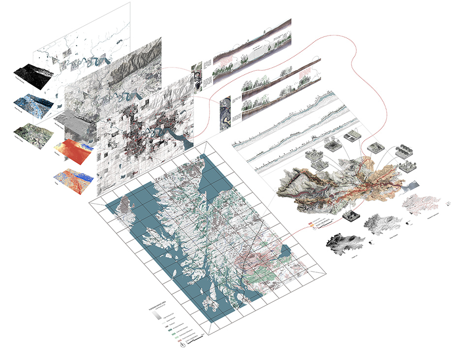
This collage selects some of the work from Part1 to show the specific location of the site and areas vulnerable to flooding, as well as river profiles, soil profiles and flow analysis at different scales to delineate areas that need to be "harnessed".
Re-presents the location of the site and the extent of the flood vulnerability zone, as well as the geological structural changes in the different areas. Explains the effect of the ecological wetland on the urban fringe that was intended to be achieved after the original proposal.
Project description
In the midst of an ever-growing environmental crisis, the tension between humans and nature has become increasingly apparent as the impact of the Anthropocene deepens. Extreme weather conditions are becoming more frequent, and their effects on our lives are increasingly profound. In Stirling, a city located in Scotland, the area's fragile ecology and soil structure contribute to frequent flooding, which poses a significant threat to the region's people and delicate agro-ecosystem.
As a result, the design focus in Stirling will be on the intersection of city and nature, known as the urban fringe, with the goal of achieving a balanced and dynamic coexistence through the concept of "Harnessing." This approach seeks to balance the needs of nature and humans, while also creating a resilient ecological space that promotes shared well-being. The creation of a large ecological wetland park is central to this design, which will enable ecological preservation, education, and shared well-being to be achieved.
The proposed ecological wetland park design in Stirling offers a sustainable solution to the environmental challenges facing the region. Through the concept of "Harnessing," the design seeks to balance the needs of nature and humans, creating a resilient ecological space that promotes shared well-being and provides recreational opportunities for the local community.
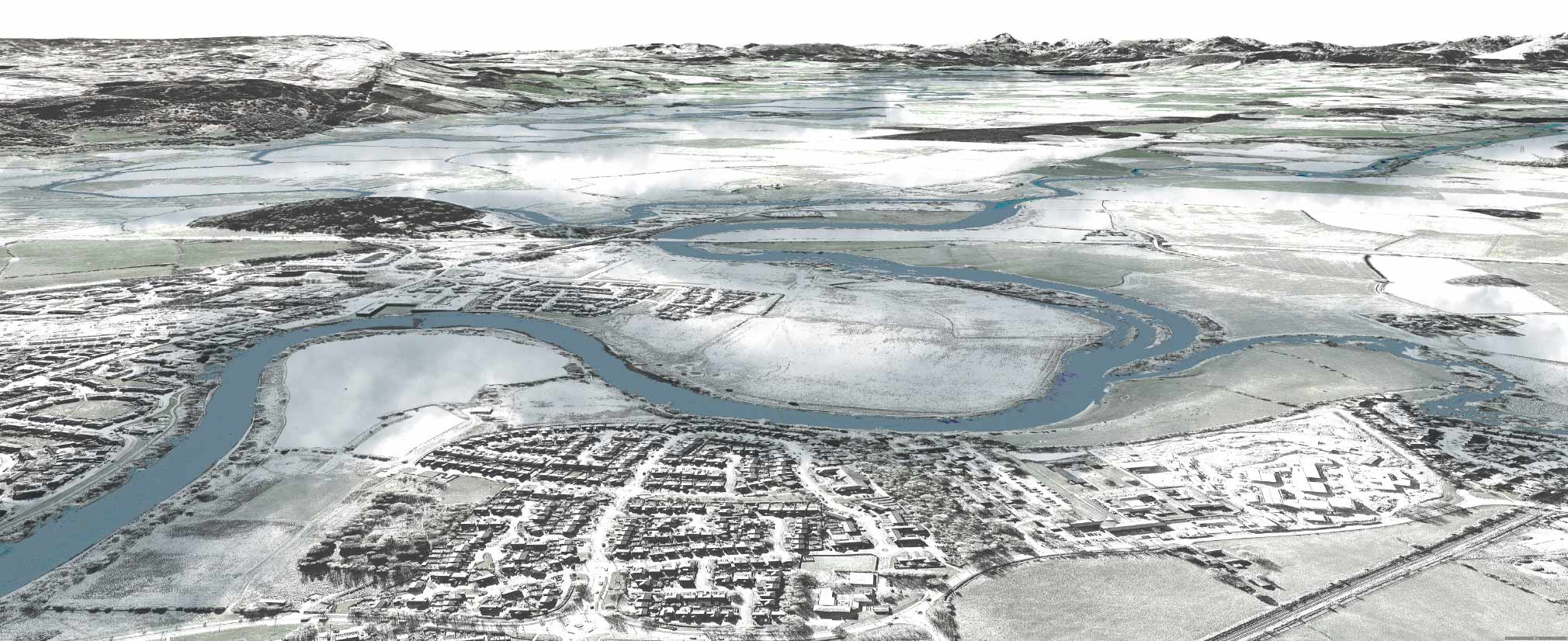
Site-Stirling
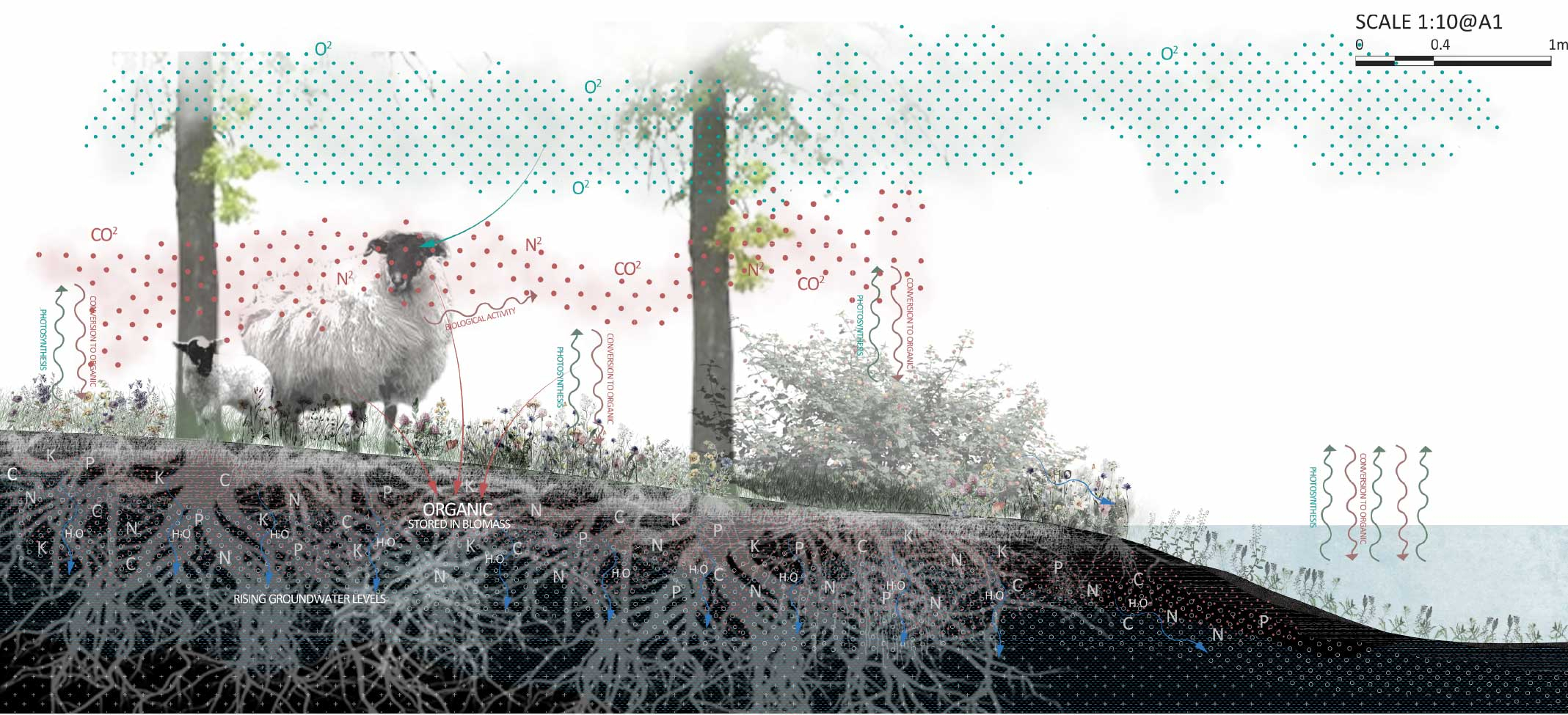
As an individual bearing life, the landscape needs time to complete its transformation with different plant growth cycles, species reproduction, ecological reconciliation, ageing, and replacement of building materials, showing itself differently in each time dimension and season. Therefore, the natural elements' influence on the landscape is inevitable, and they all need to be regulated from the scale of "Harnessing" time, with more detailed adjustments in different time dimensions.
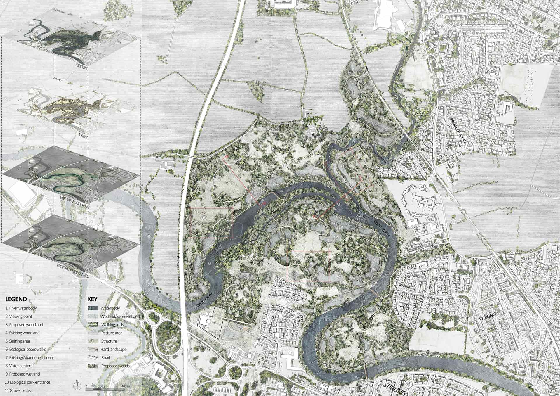
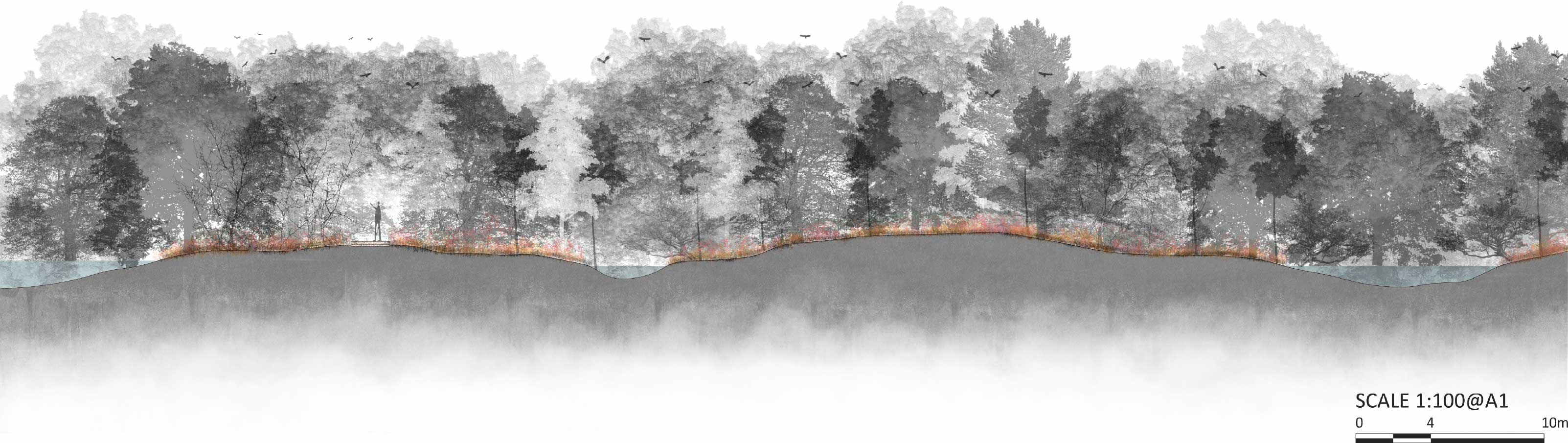
Resilient Ecological Park
The sustainable ecological park aims to prevent floods, restore native vegetation, reconcile conflicts between nature and human activities, and provide educational and recreational opportunities for the community.
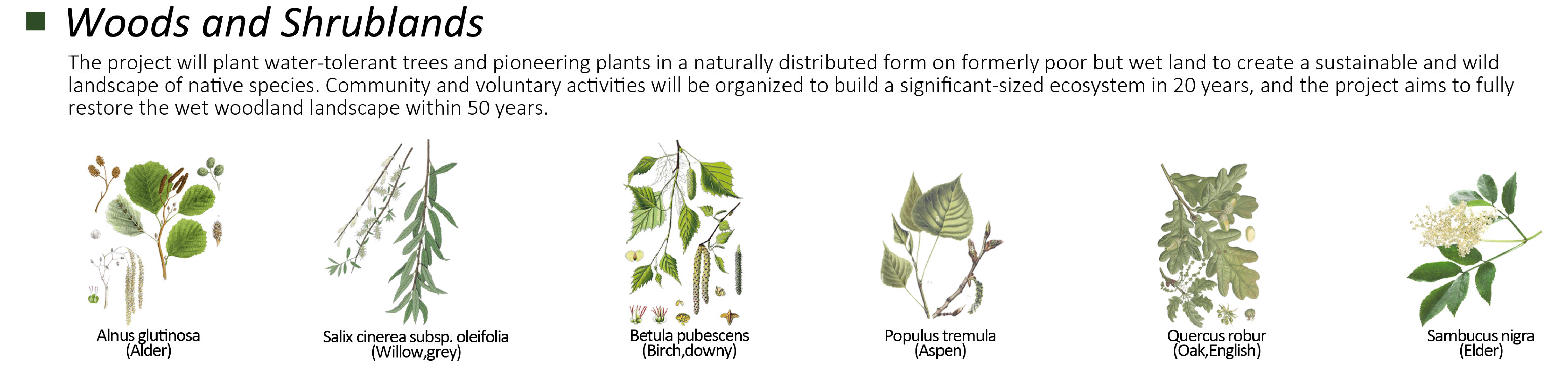
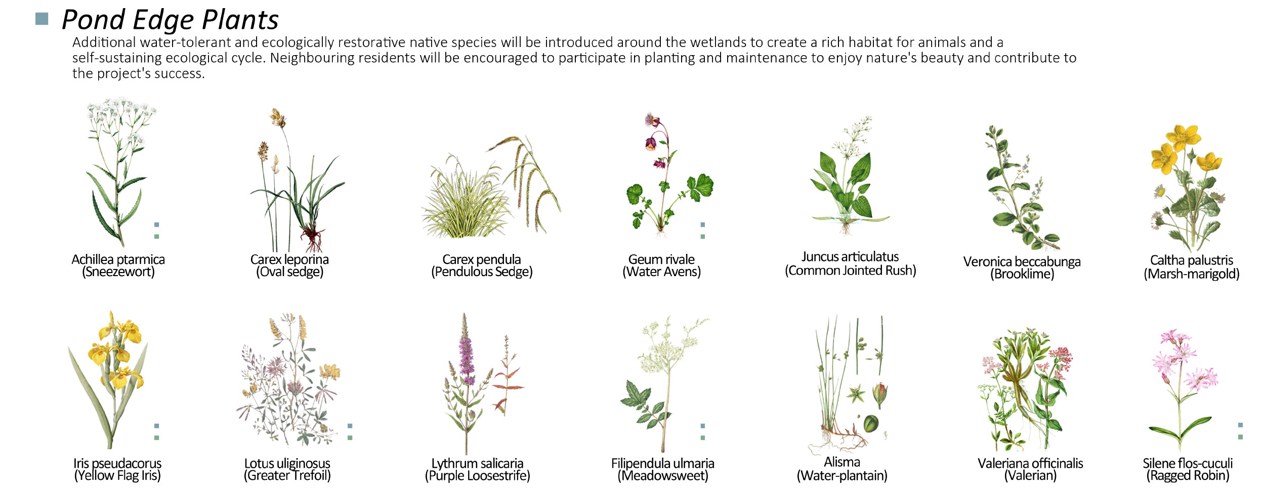
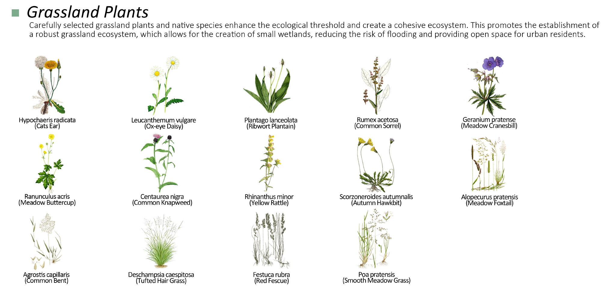
The protection of natural habitats is given top priority through the restoration of diverse local vegetation and reducing human impacts. Community participation and the use of sustainable materials ensure the establishment of habitats for wildlife and increase ecological diversity. Ecological restoration improves flood resistance and creates a new network of wetland ecosystems.
Dynamic Systems: Barren Land-Topographic Gentle Slope Design(A-A')
In extreme weather, rivers can easily intrude into the site.
Creation of artificial lowlands to promote community involvement in the project.
The initial formation of a basic wetland ecosystem.
As the ecosystem develops, continuous deposits of organic matter further enrich the soil and create a strong base for the whole ecosystem.
In 100 years, more plant and animal populations will be present and provide a diverse and healthy ecology for the whole area.


Dynamic A-A'
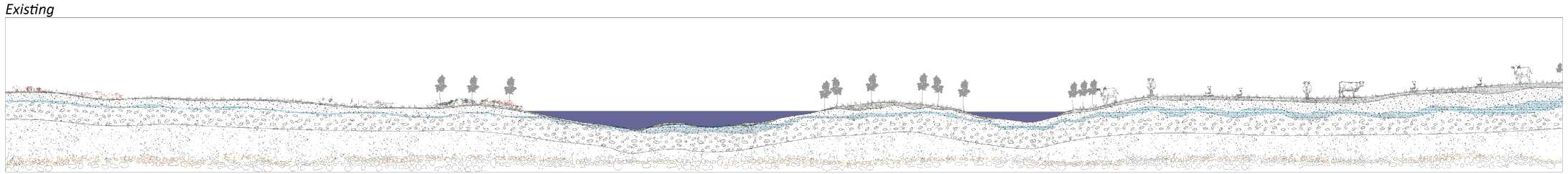
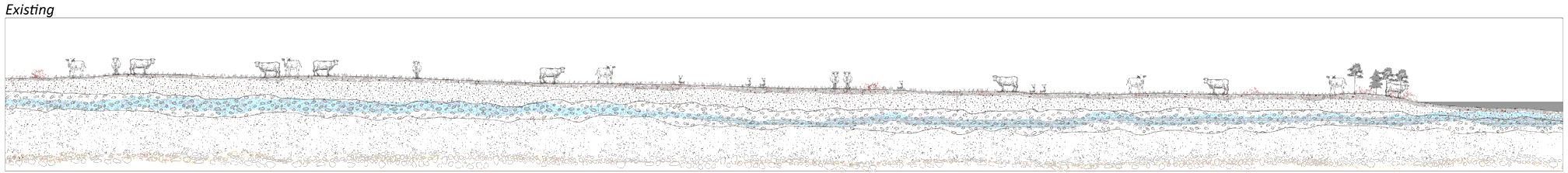
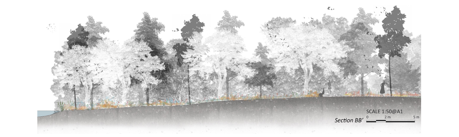
Dynamic Systems: Pasture/Agro-ecological Design(B-B')
The area is subject to strong currents, causing erosion and flooding.
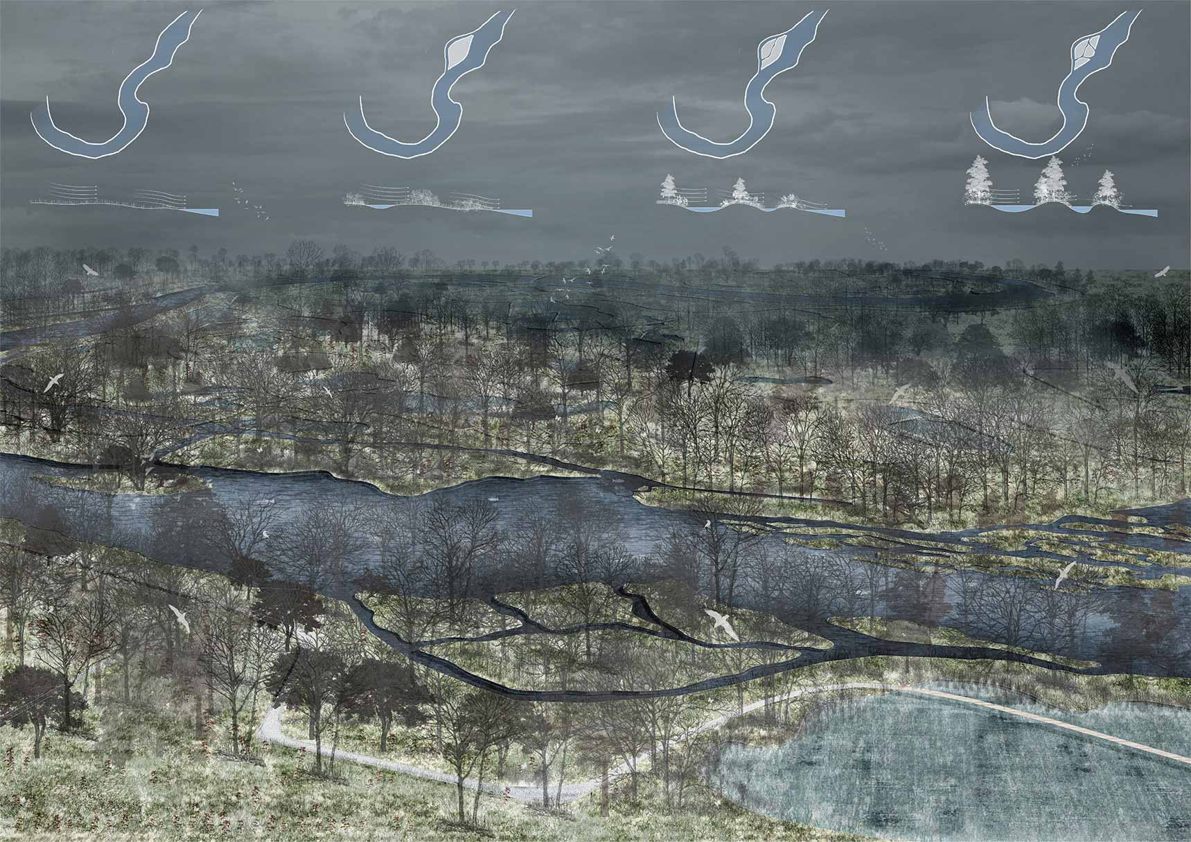
The wetland areas are interconnected and form a larger, more resilient ecosystem.
The area is more resilient to extreme weather events and the ecosystem is more stable.
The surrounding vegetation has been transformed into a diverse forest that provides habitat for a wide range of species.
Wetland areas continue to develop and support high levels of biodiversity. Ecosystems are stable and resilient to environmental change.
Dynamic B-B'
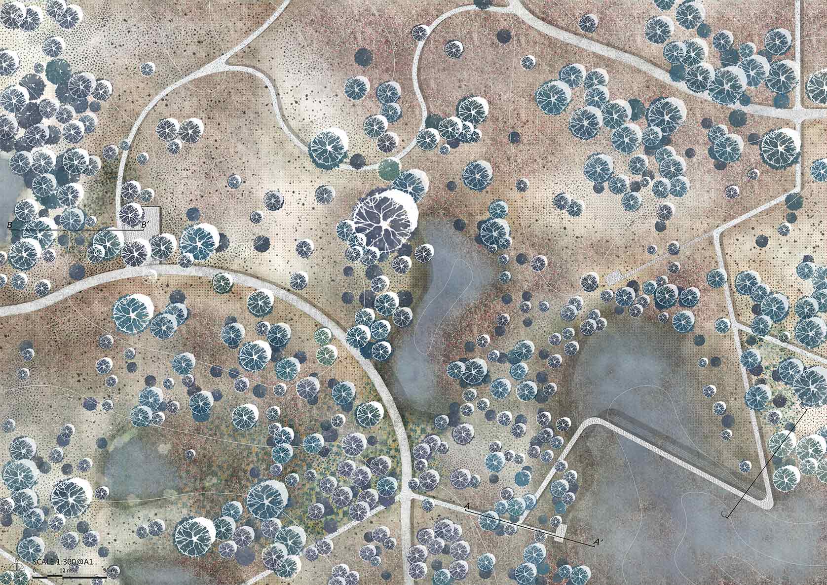
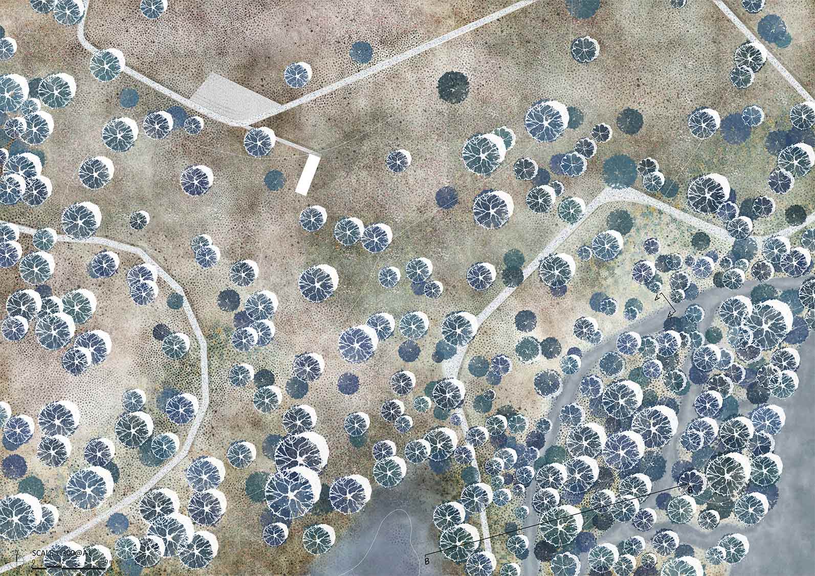
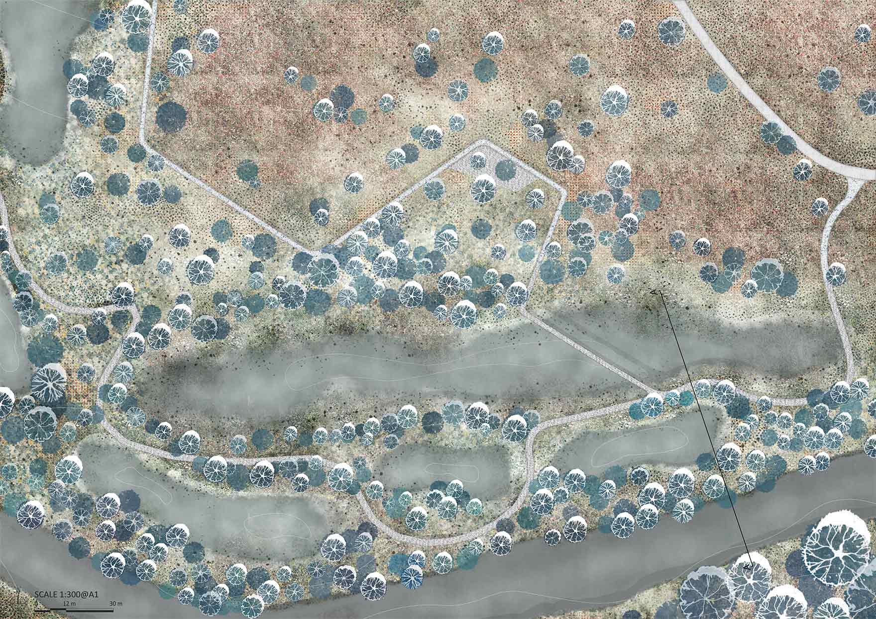
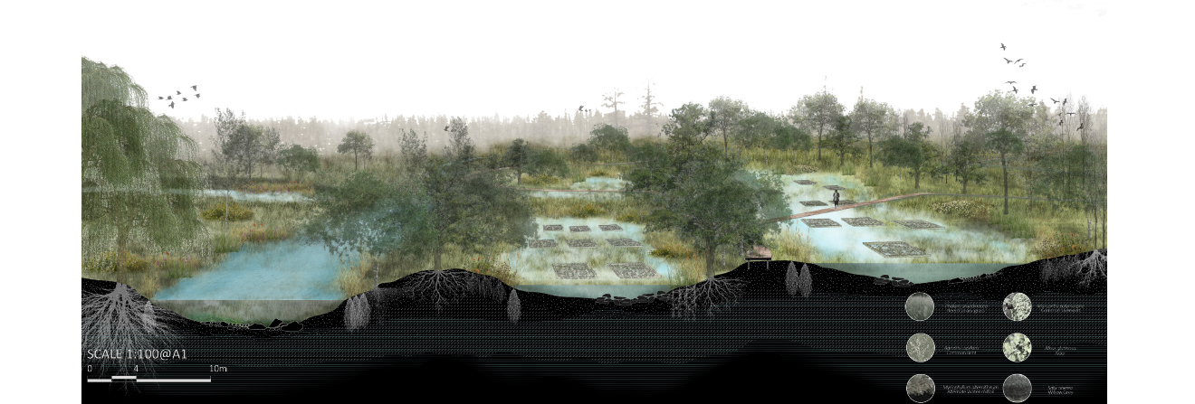
Site1 Plan
Site1 is ecological wetland reduces surface runoff and creates space for human activity.
Sustainable pathways and diverse plant species promote a sustainable ecological park, improving air quality and providing recreational opportunities for the community to connect with nature.
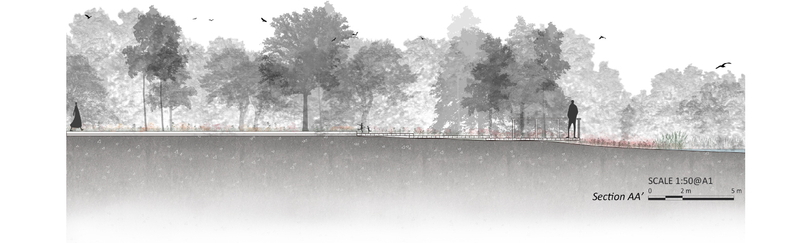
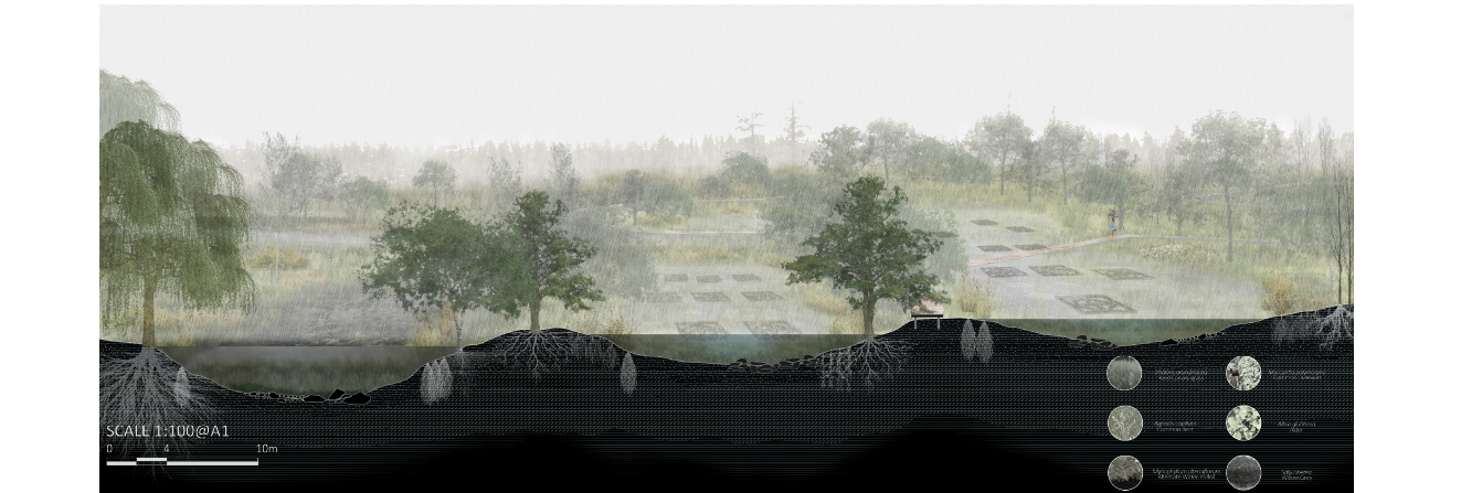
Site1 Sections
In addition, the use of native plant species is emphasized to maintain the biodiversity of the wetland ecosystem and prevent the introduction of invasive species. The selection of plants also takes into account the different seasons and their bloom times, ensuring that there are different plants in bloom throughout the year to create a vibrant and dynamic landscape.
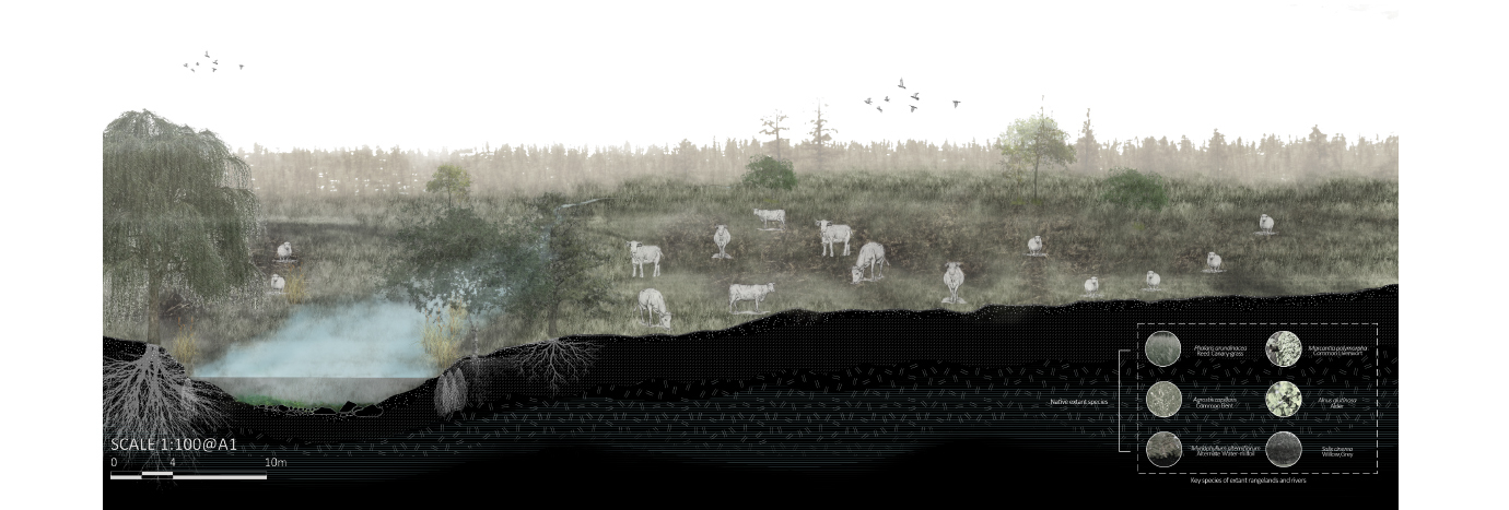
Site2 Plan
The transformation of Site 2 has resulted in the creation of a relatively complete ecological pasture design. This has been achieved through the artificial diversion of water from the river and the creation of artificial lowlands.
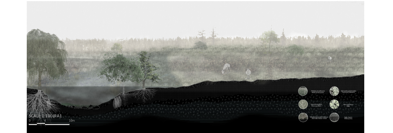
Site2 Sections
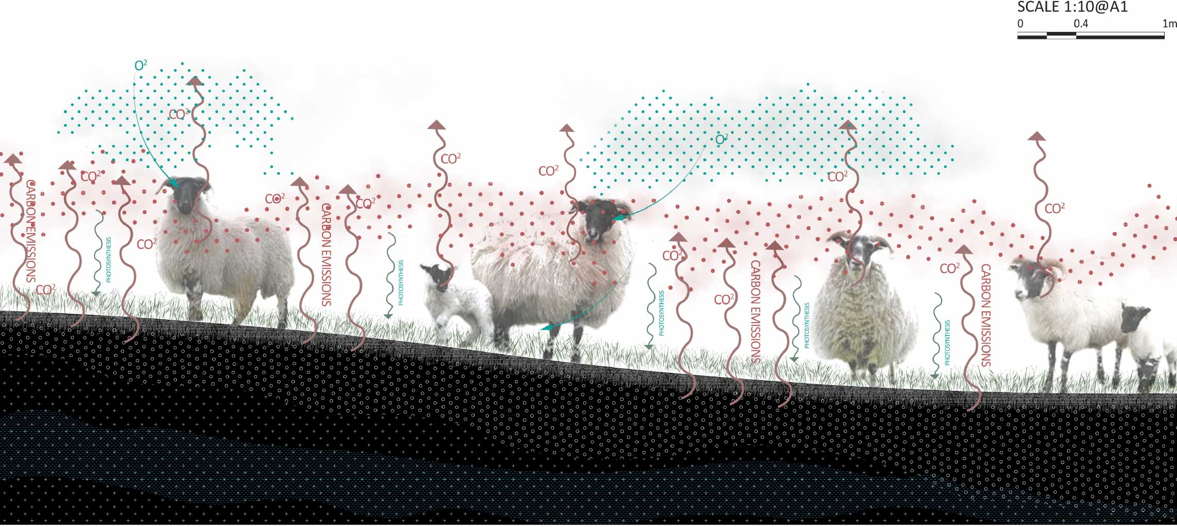
Reducing the number of livestock in the pastures can also have a positive impact on the ecology of the site. Overgrazing can cause soil erosion and compaction, leading to a loss of soil organic matter and a decline in soil health. By reducing the grazing pressure, the soil can recover and regenerate, allowing for the return of a more diverse plant community.
Ecohydrology Restoration
To slow down the flow of the river during extreme weather, tributaries have been added to the river, which not only reduces the risk of flooding but also creates a more diverse and dynamic water system that supports a variety of plant and animal life. Additionally, the formation of ecological islands further enhances the ecological value of the site by creating a habitat for wetland plants and providing an important resting and nesting site for waterfowl.
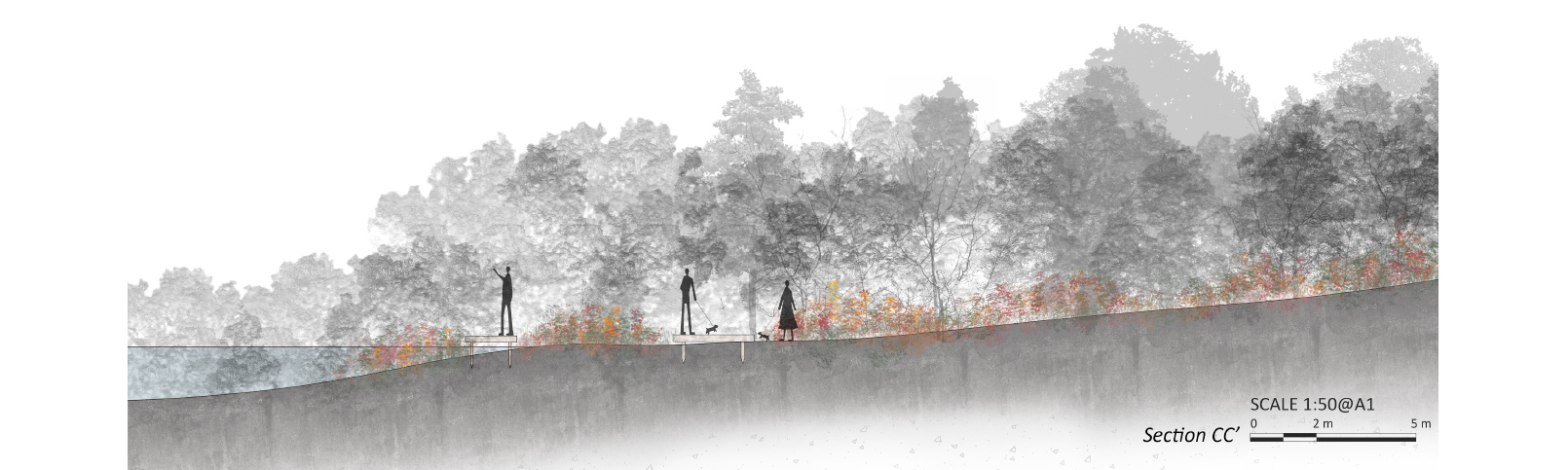
Site3 Plan
Site 3 mainly shows the combination of topographic design and the use of gentle slopes to create a wetland that not only collects and purifies water but also improves the ecological environment. The wetland serves as a natural reservoir, capturing and retaining rainwater and surface runoff, which is then gradually released to maintain the water level in the surrounding areas.
Site3 Sections
The gently sloping wetlands in the design help to control the flow of water and avoid erosion, while also creating a diverse landscape with different microhabitats that support a variety of plant and animal species. The organic matter in the wetland vegetation and soil helps to purify the water, removing excess nutrients and pollutants through natural processes.
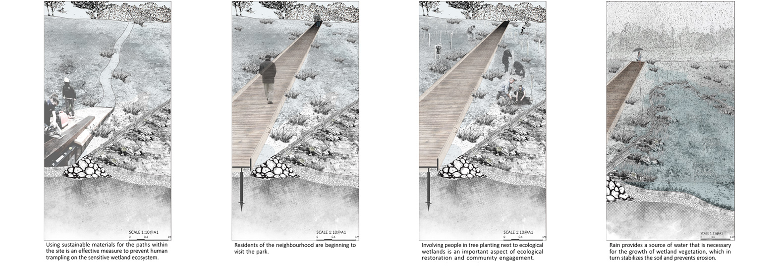
Landscape Realisation Process
This series of drawings provides a detailed visualisation of the entire construction process of the wetland park, from the initial site preparation to the final stages of the ecosystem's operation. Each drawing shows the various stages of the construction process, including the excavation and shaping of the wetlands, the planting of different wetland vegetation, and the introduction of aquatic species.
Plant Species

Zhengxu Wang
Designing Resilient Futures:Stirling fringe ecology enhancement
Follow:
Share: